With somewhat limited options because of the coronavirus situation, it’s time for another domestic road trip from Oslo across the mountains to Norway’s west coast.
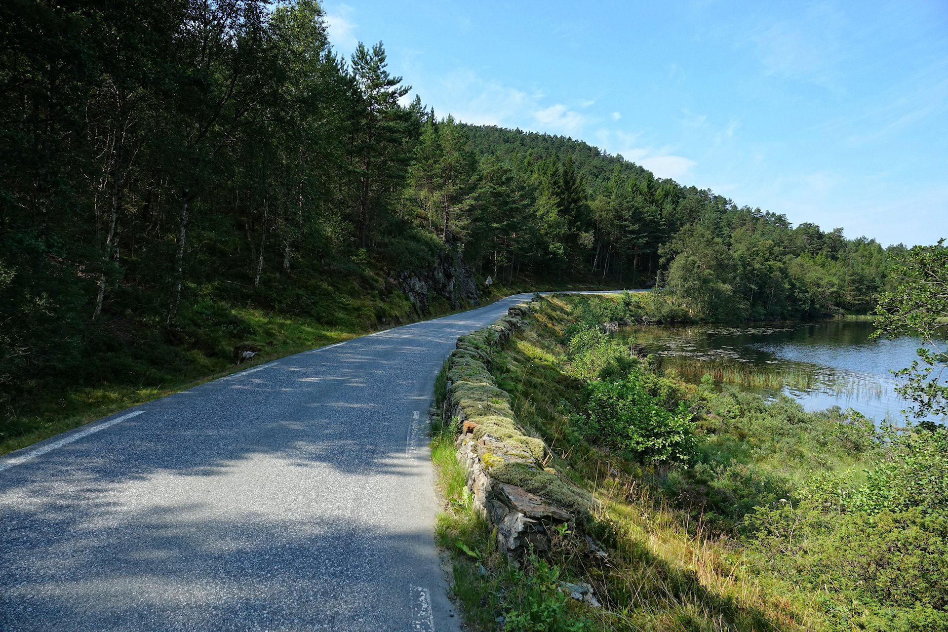
In Vestland county there’s always another narrow road you haven’t noticed before, which will bring you to a place where rocks and water meet in the most surprising and pleasing ways. No need to plan ahead, just get in the car, and off we go.
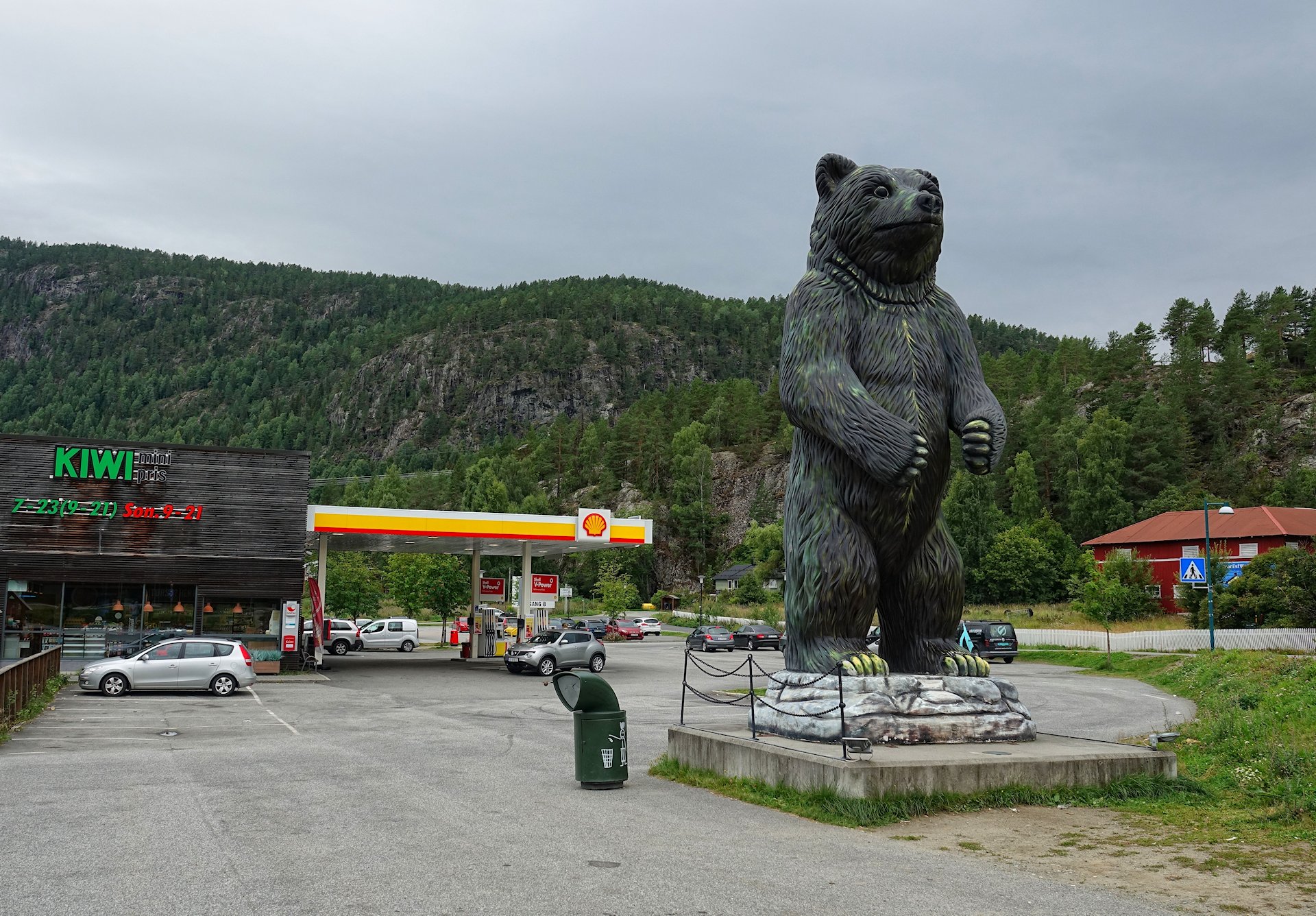
After a couple of hours driving past forests and farms we reach Flå, famous for its bears.
Not to worry. They’re all captive, there are just four of them, and they’re treated relatively well compared to most jailed animals. If you accept the premise of a zoo, two to three hours here will make a good stop. We, however, will just pee and move on.

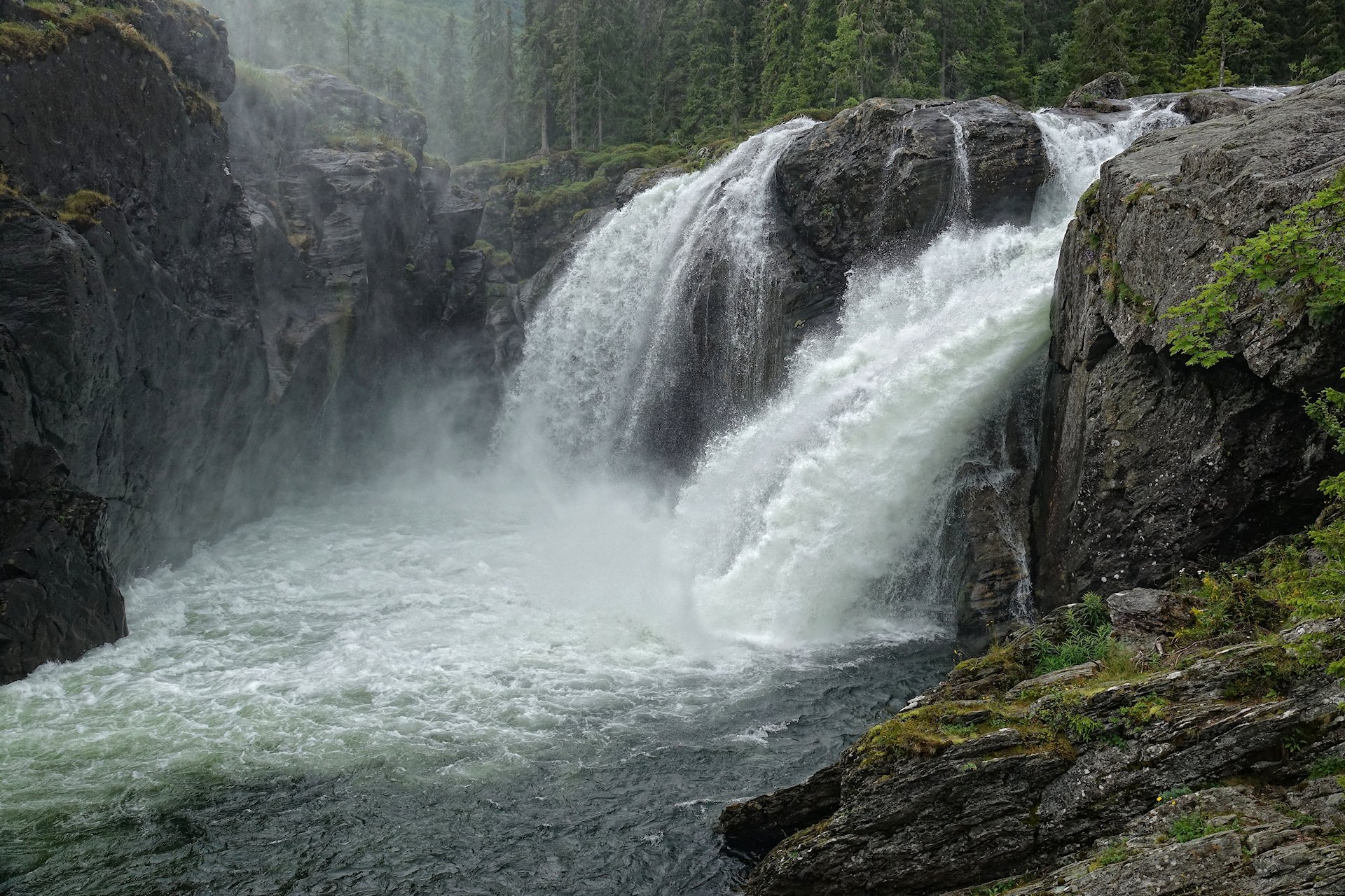
Continuing north, we drive towards Hemsedal. This is where some proper mountains start appearing. And with mountains comes waterfalls.
This is Hydnefossen. In dry times like these, it looks like a twin pair of waterfall. If you come here in wetter weather, it’ll be a mightier sight. This still works well as a gentle introduction to what lies ahead of us.
Past Hemsedal we stop because of a smoke-like mist coming out of the forest right next to the road.
Investigating further, we discover that it’s actually Rjukandefossen, which fittingly translates into “Smoking waterfall”. It’s pretty much a drive-in attraction. If you for some reason is bored by wild water like this, there’s also an option to zipline straight through the waterfall.
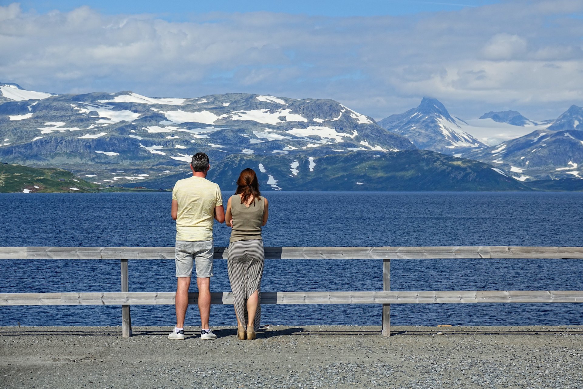
Continuing north we reach Lake Tyin, at 1,084 meters above sea level. Here we get our first view of actual glaciers.
It’s a humbling sight, seeing ice that may have been occupying it’s current location since the last ice age, at least 11,000 years ago. If it’s your first time here, there’s a good chance you’ll just stand and stare for a while, like these two.

Unfortunately there’s nowhere to stop on the narrow and winding road that takes us down from Tyin to almost sea level and the town Øvre Årdal. But as soon as we reach the town, we park our car and take in the Hawaii-like dramatic mountains surrounding the settlement.
People live here because there’s work to be found at a large aluminium smelting plant. Cheap and safe hydro power can be pulled out of this kind of landscape, making the area a perfect place for conducting energy-intensive processes. It’s a bit strange to see pristine scenery like this located right next to a massive industry complex, but it’s just a matter of looking in the right direction and ignoring what’s behind you.
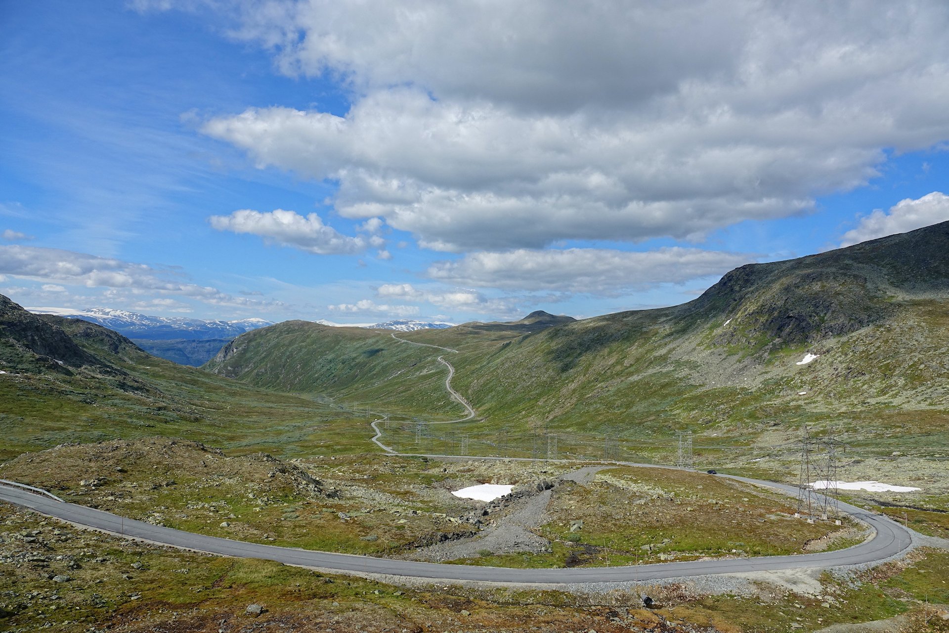
Hidden away on the north-western side of Øvre Årdal is the entrance to a road that begins with a series of hairpin turns; Tindevegen, “Road of Peaks”. On it, we quickly ascend a thousand meters closer to the heavens. From here we can look up another thousand meters and more to some of Norway’s highest mountains.
The road is open during summer only, and primarily used by tourists. It’s in good shape, although a bit on the narrow side. Just drive slowly, and you’ll be both safe and able to appreciate the view.

Thanks to us humans who have hunted most predators around here to extinction, sheep and cows can now freely roam in the mountains. They’re a reason in themselves for going slow, as they love sleeping on the relatively warm surface of the road.
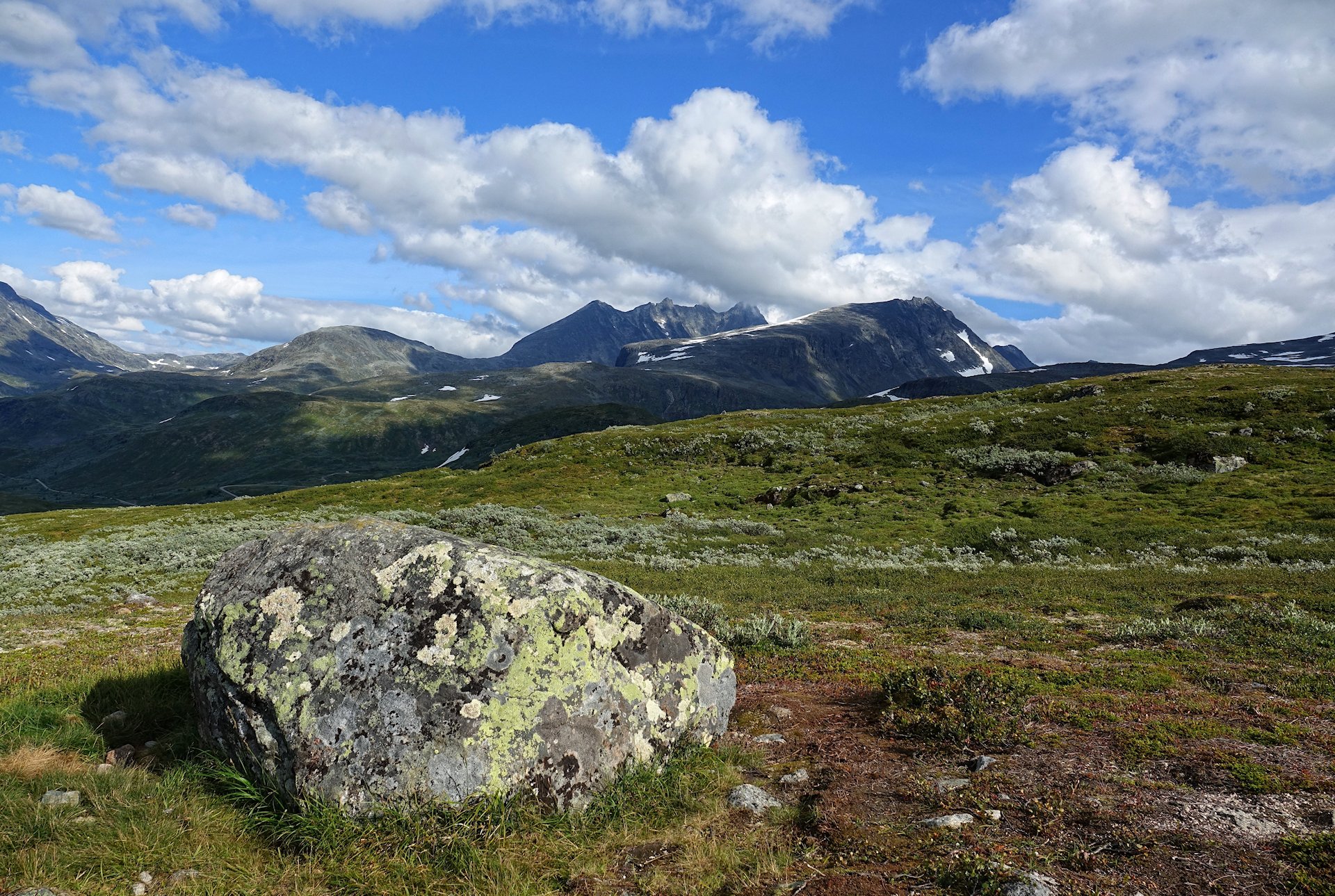
A view of the Hurrungane mountain range from Hongi, a rest stop near the northern end of Tindevegen. A small hike allows for some incredible views of both the mountains further inland in one direction, and Lustrafjorden and the Fortun valley in the other.
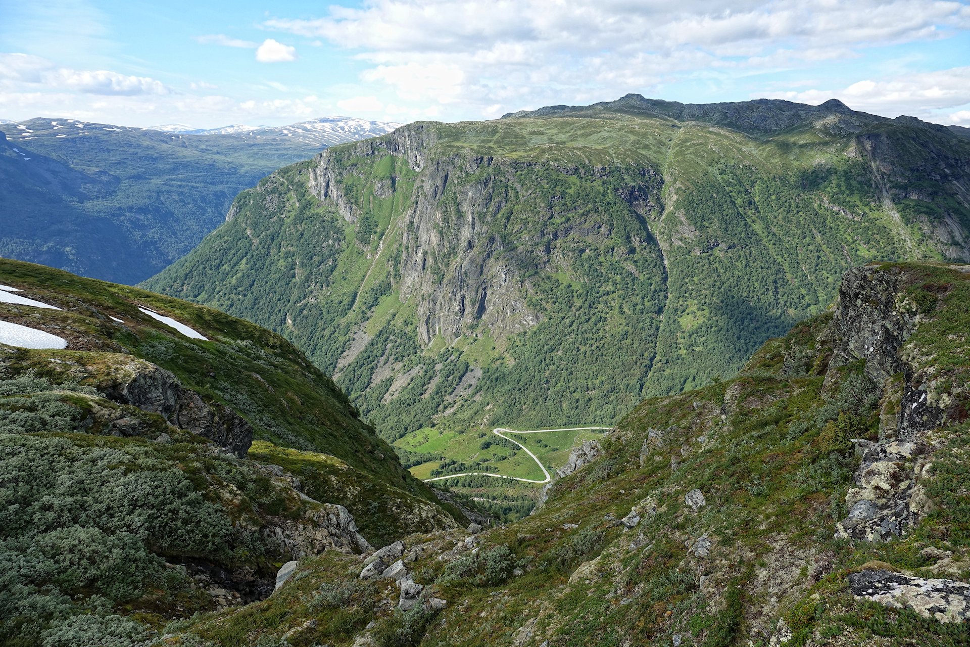
We also catch a glimpse of the entertaining bendy road between Turtagrø and Skjolden, which we will have to navigate sometime before nightfall.
But we have a lot to see up in the mountains before we have to worry about that.
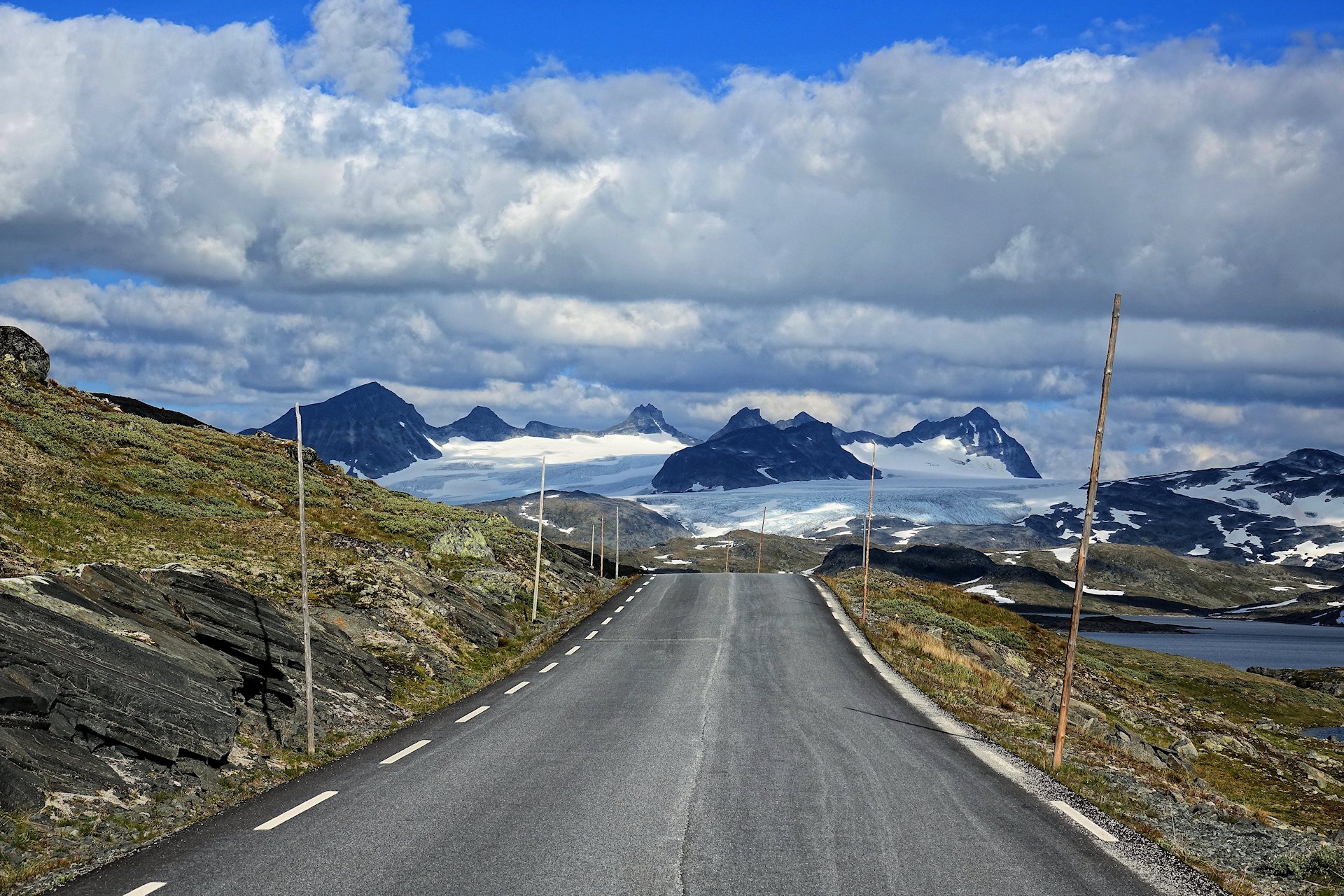
We enter Sognefjellsveien, one of Norway’s National Scenic Routes, driving north from Turtagrø. Open only between May and October, it’s an invitation to immerse yourself and your vehicle in some of the roughest nature you can find in Norway.
At an altitude of 1,440 meters above sea level, we’re given the opportunity to look down at both snow and glaciers, even now in the middle of the summer.
At the Nufsgrøvan waterfalls we turn around. From here it’s possible to continue north towards Lom and Jotunheimen, but we’re heading back to Sognefjorden to travel south.
This is a road you want to drive both ways, anyway. Each direction offers different views in the often quickly changing weather and light.
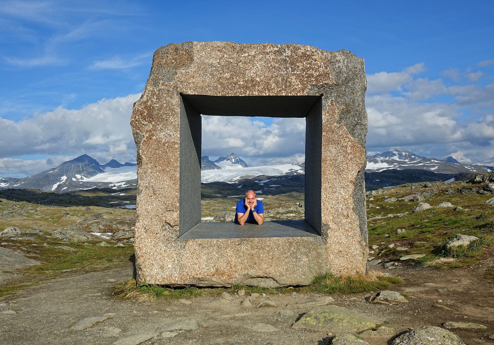
Mefjellet rest stop has this interesting piece of art, “Steinen”/”The Rock”, by Knut Wold.
It’s difficult to frame nature, especially with the scale of these mountains, but this certainly is a fascinating attempt.
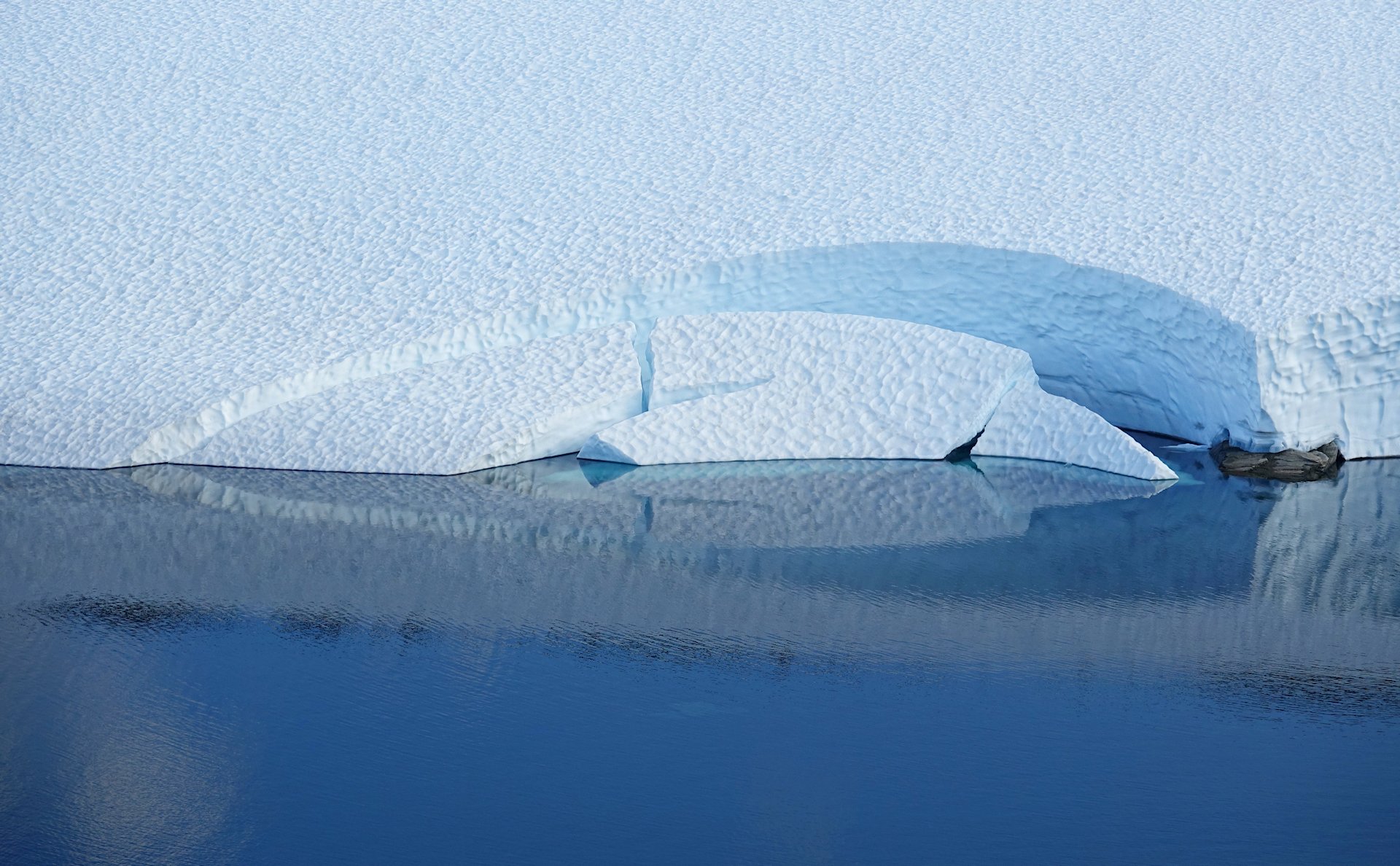
A glacier beautifully feeds into Prestesteinsvatnet lake.
When the weather plays nice here, you can see every kind of blue all at once.
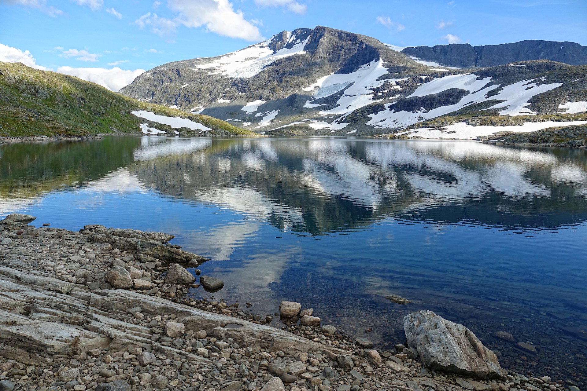
A nice reflection in Hervavatnet lake, gives us a double view of the beautifully named mountains Fannaråki and Steindalsnosi.
I mean, the Himalayas are clearly a lot taller and more impressive, but the Sognefjell mountains can totally compete in the cool names category.
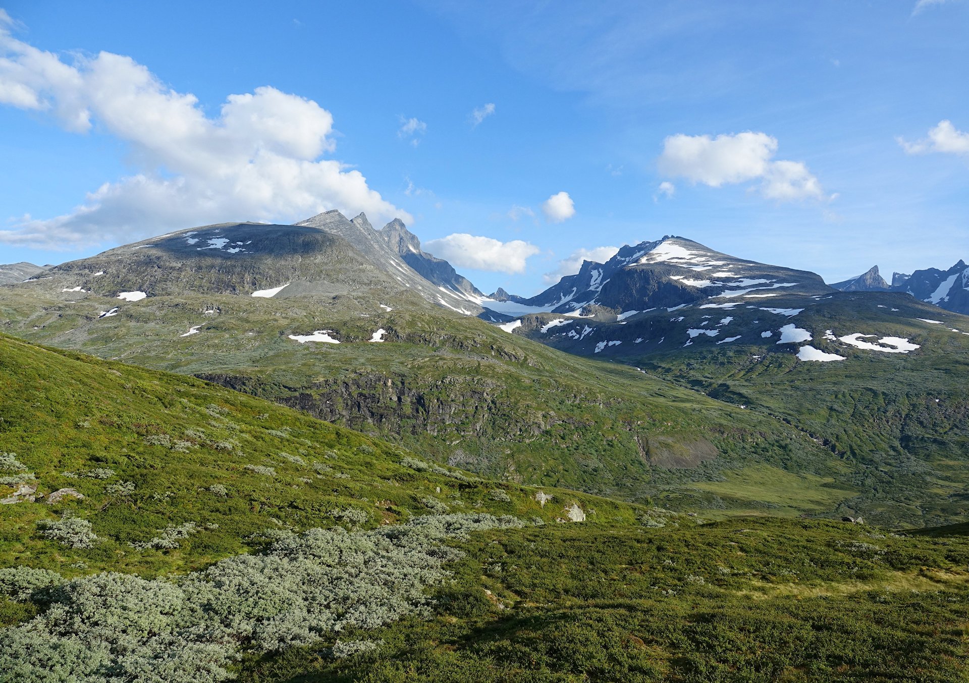
A few more jagged peaks to prove my point regarding names, as seen from the Oscarshaug rest stop; Styggedalstind, Skagastølstind, Midtmaradalstind, Dyrhaugsryggen, Austanbottstind, and Solebotntind.
These peaks are all above 2,000 meters high, and more or less hikeable. Not for us today, though.
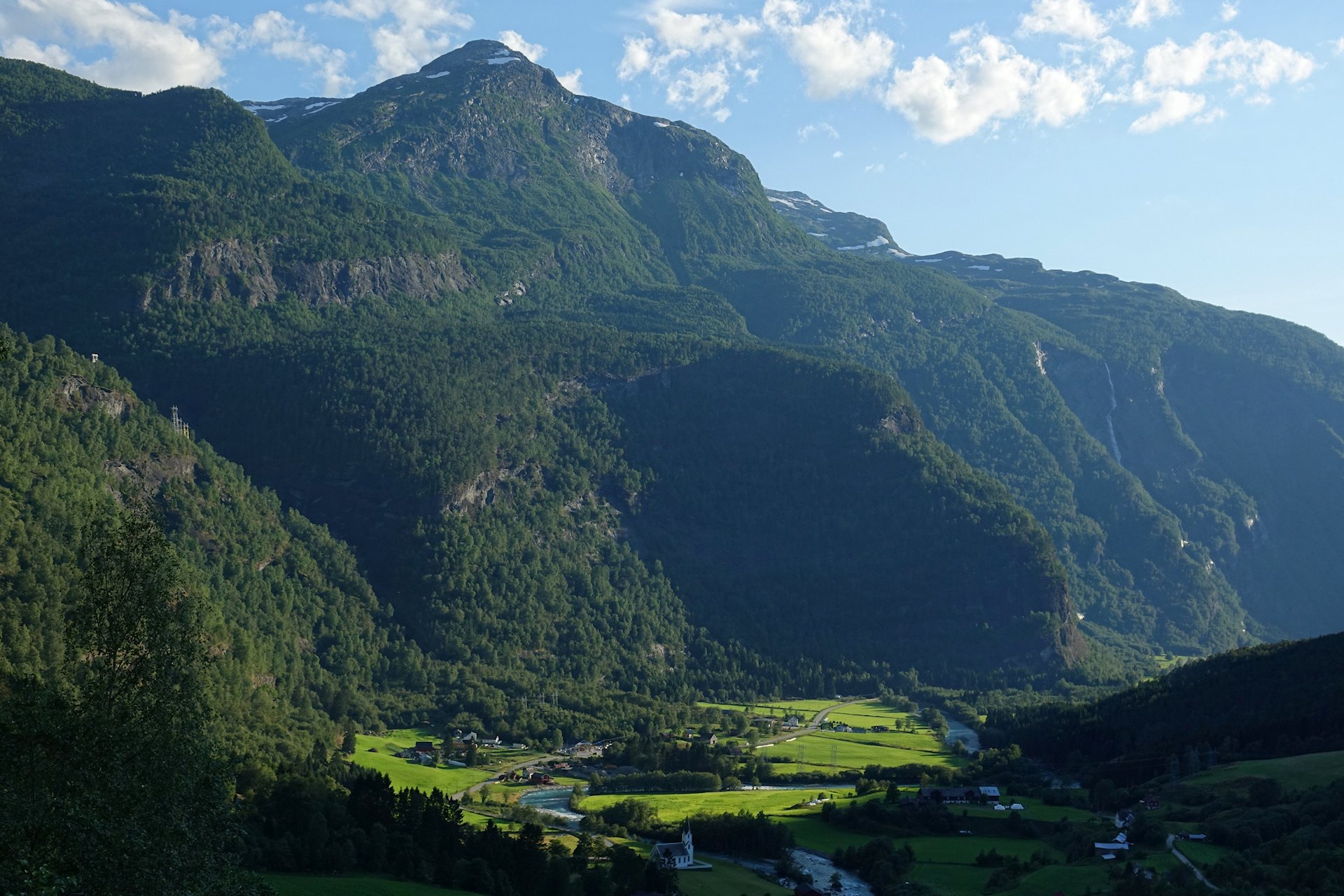
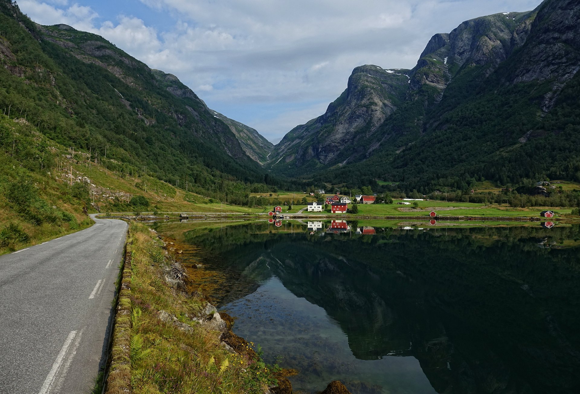
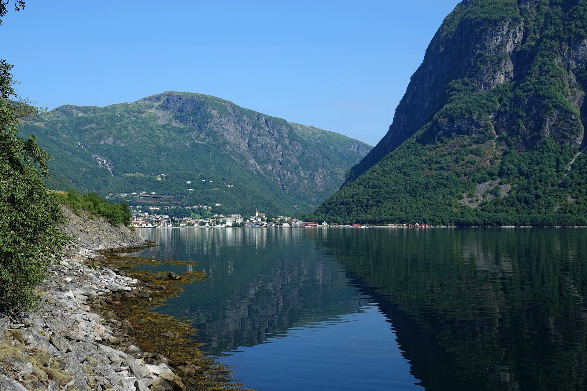
Heading down Bergsdalen valley, we get a good look at Fortun village.
Villages in this part of Norway are often almost completely surrounded by steep mountains. I don’t imagine there’s much skin cancer going around here. No sooner does the sun appear from behind one mountain, before it disappears again behind another one on the other side of the valley.
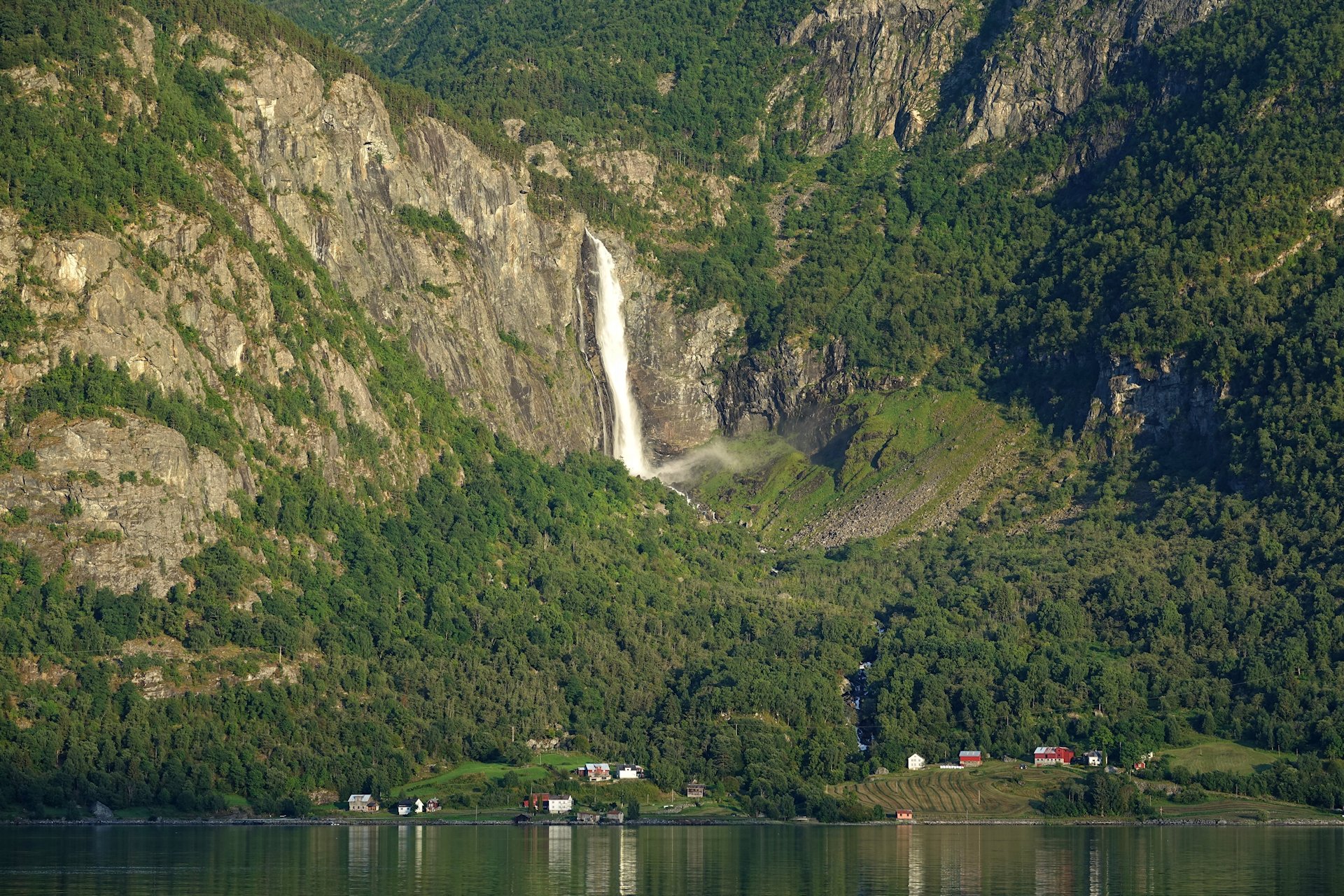
Fantastic waterfalls keep popping up behind every turn on the road along Sognefjorden. This is Feigefossen, a 200+ meters vertical drop, and one of very few waterfalls in this area that haven’t been impacted by hydro power plants.
If you want to get closer to it, it’s an easy 45 minute hike from this village, Feigom.
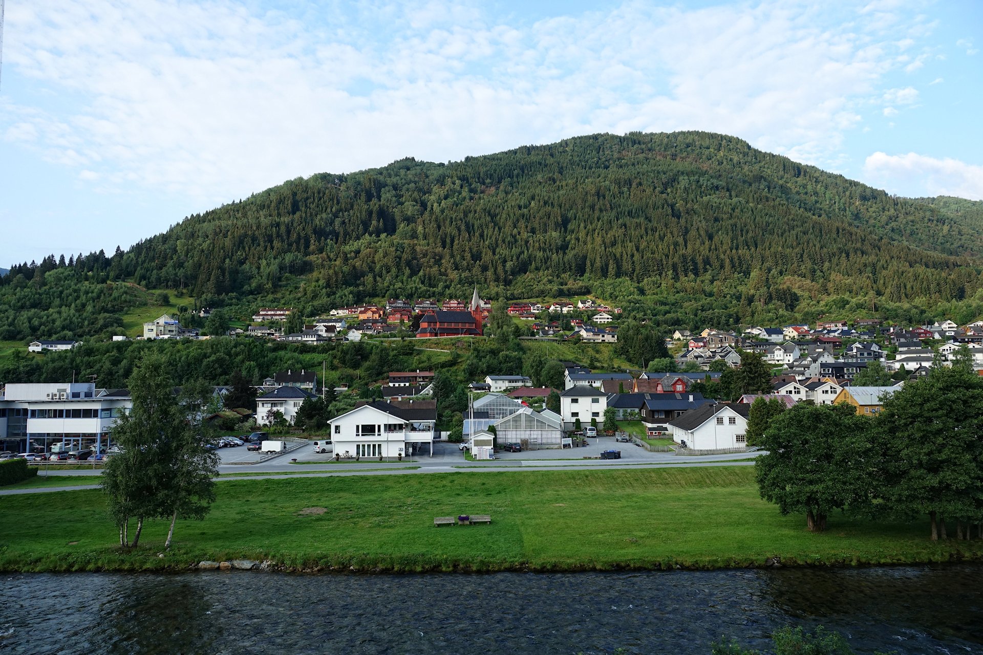
We spend the night in Sogndal, at Quality Hotel Sogndal. It’s located in the town center, and this is the view from our room. It’s typical for Vestland and much of Norway in general; people live in nice, wooden houses high enough up in the hills to avoid the annual flooding of the river when melting of snow coincides with heavy rains in the spring.
Day two starts with us going to Balestrand. It’s either an 186 kilometer drive, or it’s a ferry ride and a 46 kilometer drive. Ferries aren’t cheap, but paying for the fuel to travel by land would cost more and take longer.
Scenery-wise, both options are equally wonderful, but we have seen much of the alternative drive before, so we go for a morning cruise on the ferry, from Hella to Dragsviki.

Nature seems just impossibly pure around here. The cows, sheep and horses we see must be living the dreams of their species. Fresh air, ample space, green grass in abundance, and the nearest butchery is a long drive away. I wouldn’t mind living like an animal here for the summer. I think.
From the ferry landing we follow yet another National Scenic Route; Gaularfjellet. This takes us past Sværen, a hamlet surrounded by this masterpiece from whoever makes landscapes.
Next we’ll go up on that mountain. It can be done by hiking up the valley, but we’re going to drive around to the other side of the mountain and climb it in our car.
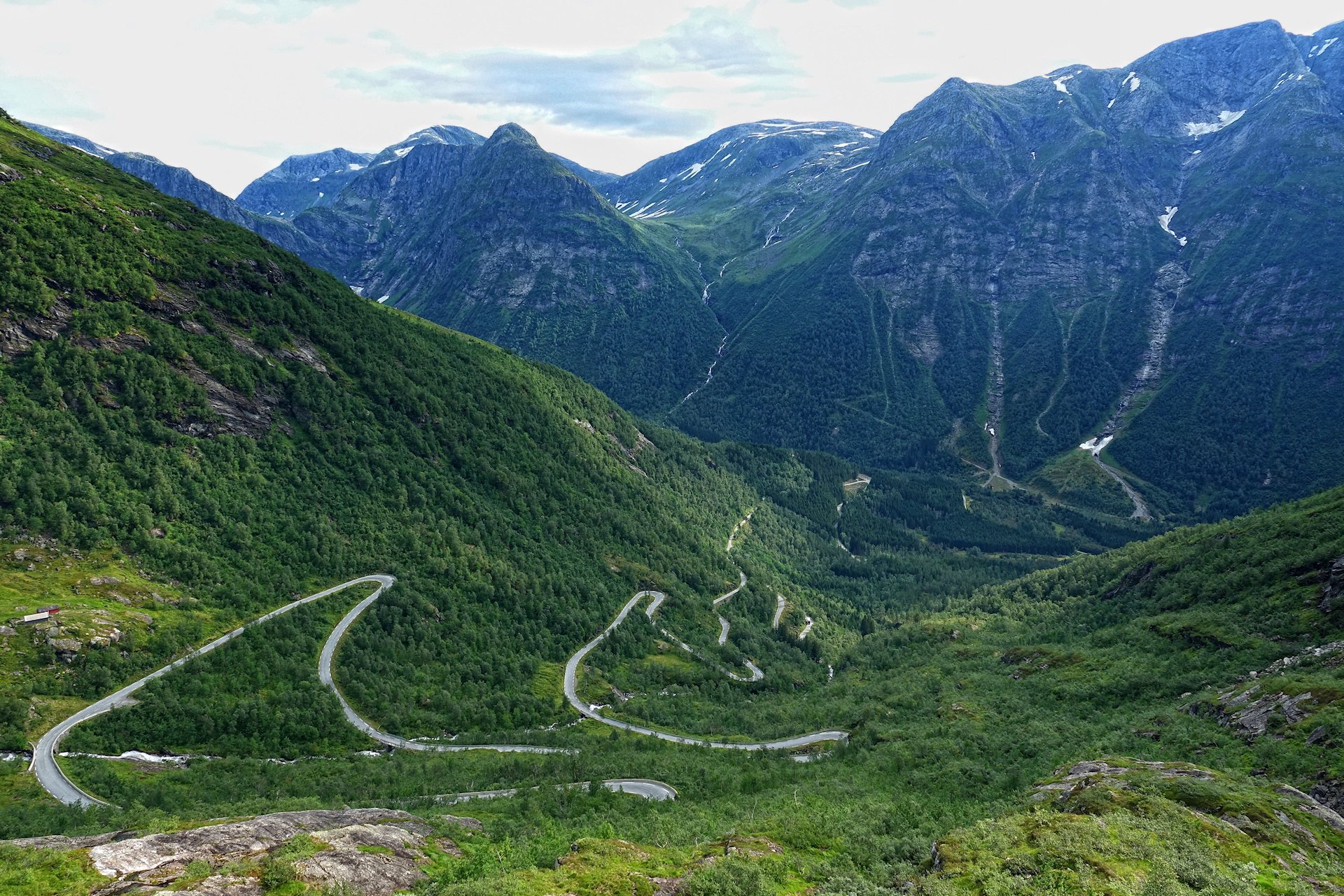
Here’s the climb, as seen from the rest stop at the top of it; Gaularfjellet Utsikten.
Getting up here takes about ten hard hairpin turns, and we can study most of them from this spot.
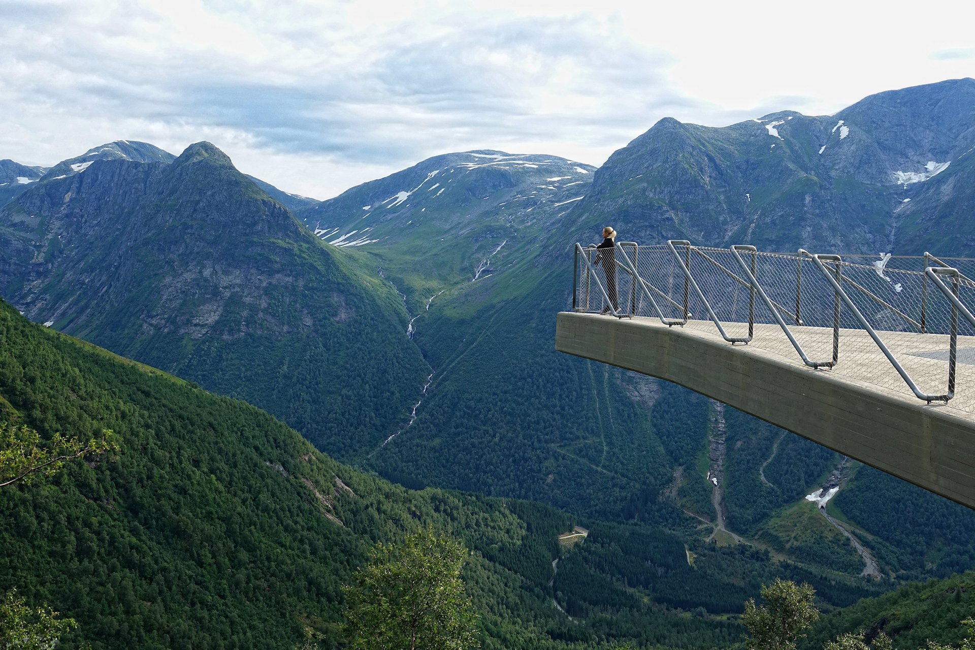
This is the public platform at Gaularfjellet. Trusting science and engineers, we spend a good while standing on it while we admire the surroundings.

Next we want to visit Balestrand, so we have to head back down all those bends again.
Passing Meland, this looks like a great place to live and work if all you want is to mind your own business and create your own luck in life. Some farming required.
The drive towards Balestrand is dream-like. One incredible vista after the other unfolds in front of us.
You want to stop the car all the time, and in many places we can. There are signs showing the way to so many tempting trails everywhere. If I lived here, I would be hiking all the time. But we have to stay on the road. It’s both wonderful and depressing. It’s at least comforting to know that I can return to these places almost anytime I want to.
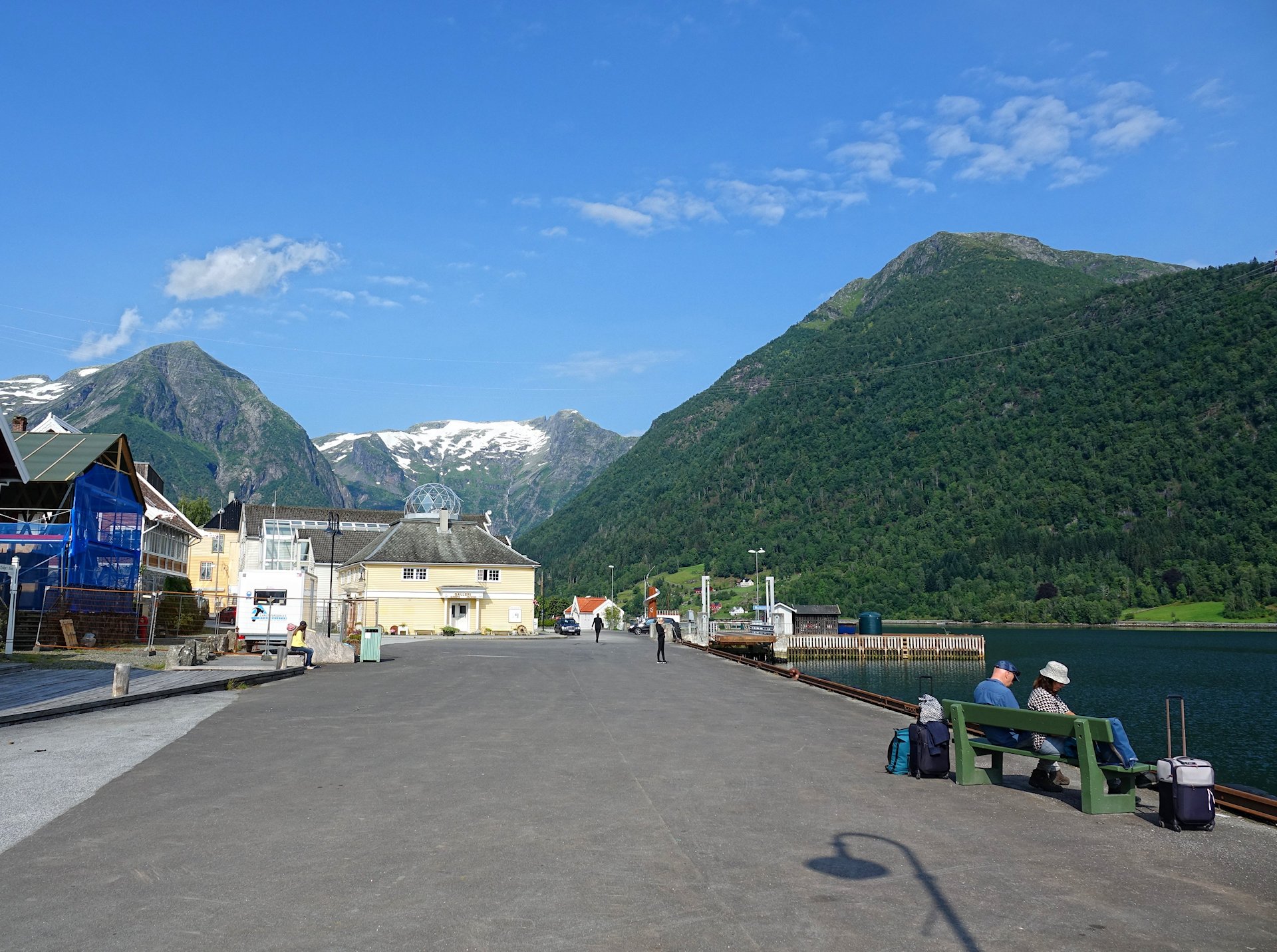
As we should have expected after hearing so much fuzz about it in foreign travel blogs, Balestrand turns out to be the most touristy village on this trip. Everything is picture-perfect pretty. There’s a Viking bar, a church with sermons conducted in English, and a giant historic hotel facing the fjord.
The village is still highly enjoyable, mainly because the coronavirus situation means that there are barely any tourists around.
This is the scene in the port of Balestrand. It’s quiet, with just a few people sitting around, waiting for the daily boat to Bergen to arrive. A bench, this view and a book, is all you need to be a happy traveler.
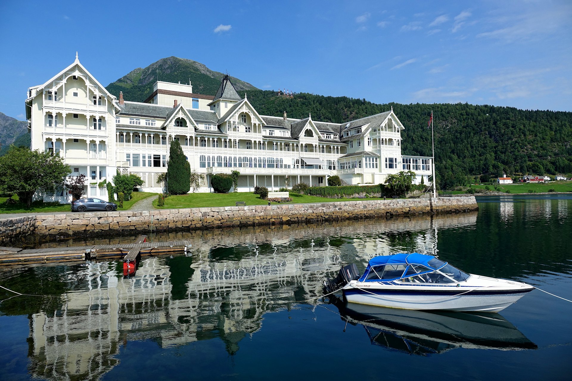
Here’s the grand fjord hotel in Balestrand, Kviknes Hotel. A less attractive annex from the 1960s is hiding in the back, but all in all you definitely can get the atmosphere you expect here. And on a sunny day like this, there’s really nothing you could complain about here. They even provide two official Tesla charging points.
Does looking at the Tesla and/or being reminded of missed investment opportunities bug you?
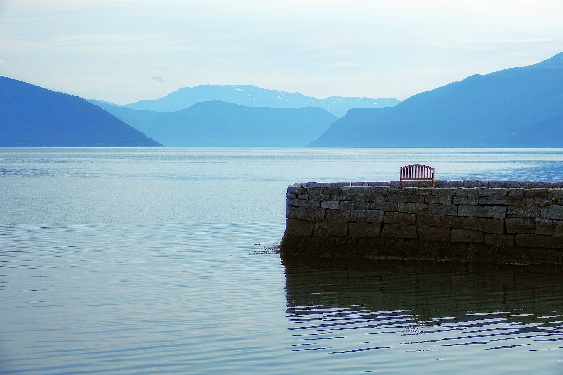
Just turn around and have this view of Sognefjorden calm you down.
Actually, most of Balestrand seems designed to have a soothing effect on a stressed-out mind. Every garden is immaculate, every house is old, yet well maintained, and the surroundings couldn’t be more like a postcard.
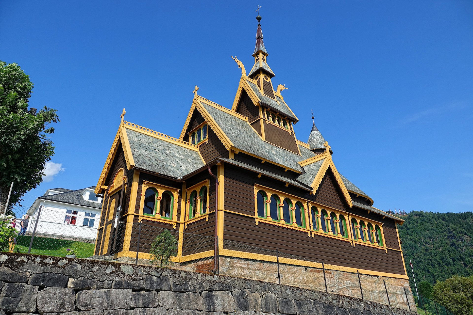
To top it off, there’s a stave church lookalike in the middle of the village. Being from 1897, it’s practically brand new, but it’s got all the necessary pretty details. Especially if you go inside.

If you’re a Disney afficionado, you may find the interior suspiciously similar to the chapel in Elsa’s coronation scene in Frozen.

It’s almost, but not quite, entirely unlike the English Church in Balestrand, you have to admit.
We continue our drive along Sognefjorden, with water on one side of the car and steep mountain on the other. Soon we reach Høyanger, another factory town built around a huge aluminium plant.

Like all the other towns we’ve seen so far, Høyanger seems pristine and pleasant to live in, with infinite hiking options right on their doorstep.
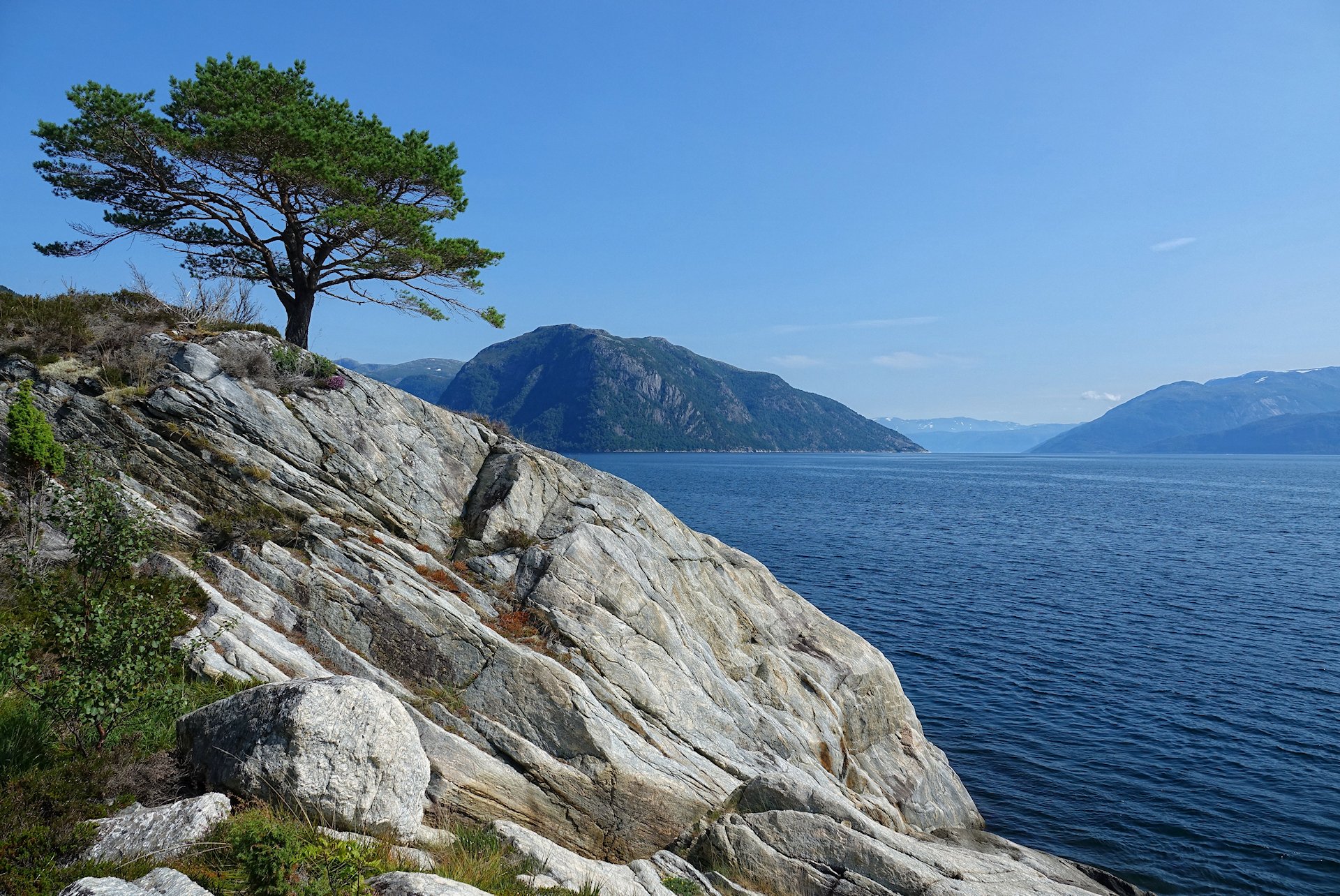
At Kyrkjebø we go on a short hike to find a geocache. As a bonus, I find this lovely lonely pine tree living on the edge of Sognefjorden.
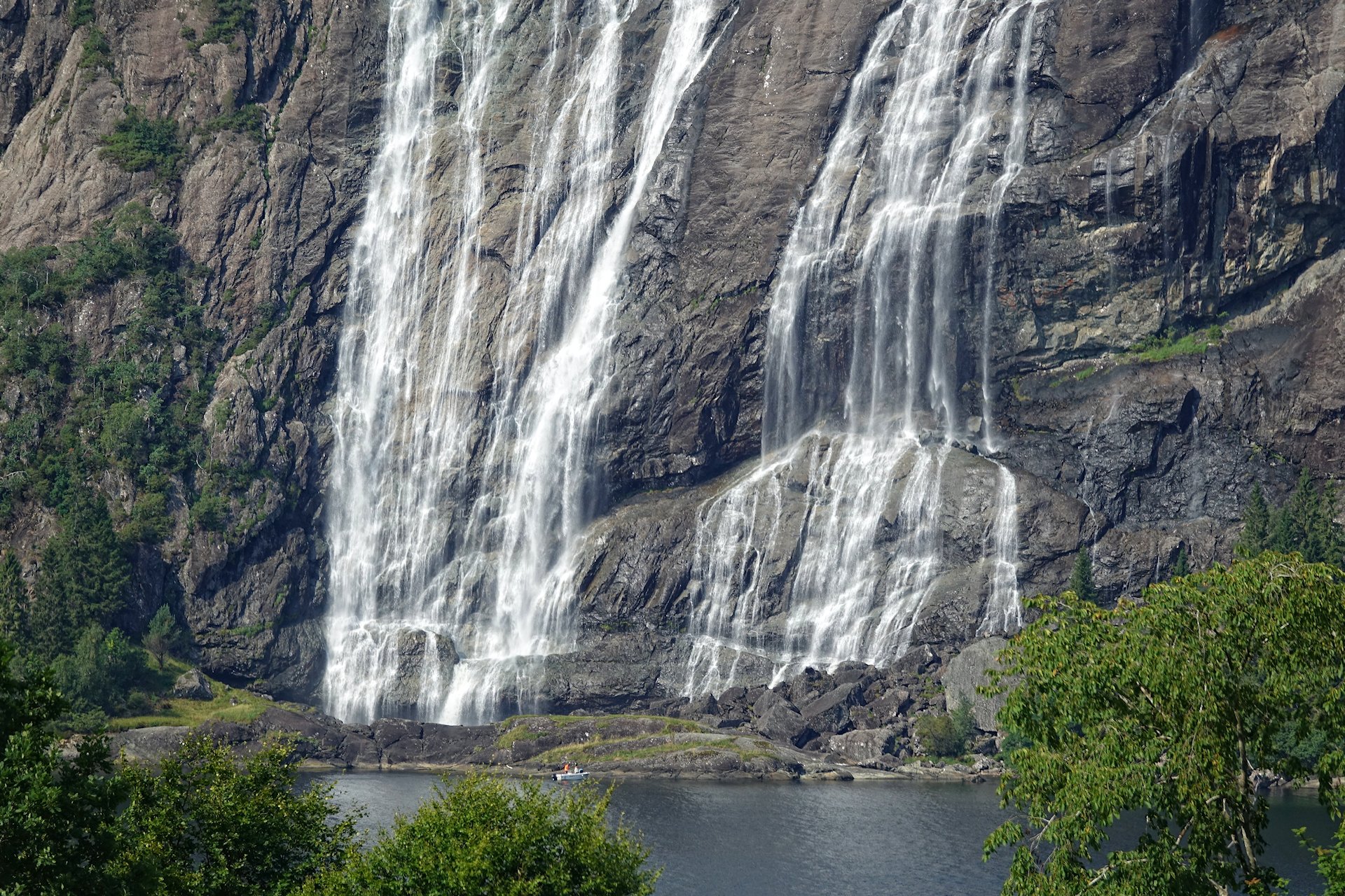
Cutting north from Vadheim, we reach Dalsfjorden. It’s much smaller than Sognefjorden, but that doesn’t prevent it from having this amazing waterfall; Laukelandsfossen. To get a grip on the scale of this natural wonder, note the boat and the humans at the bottom of it.
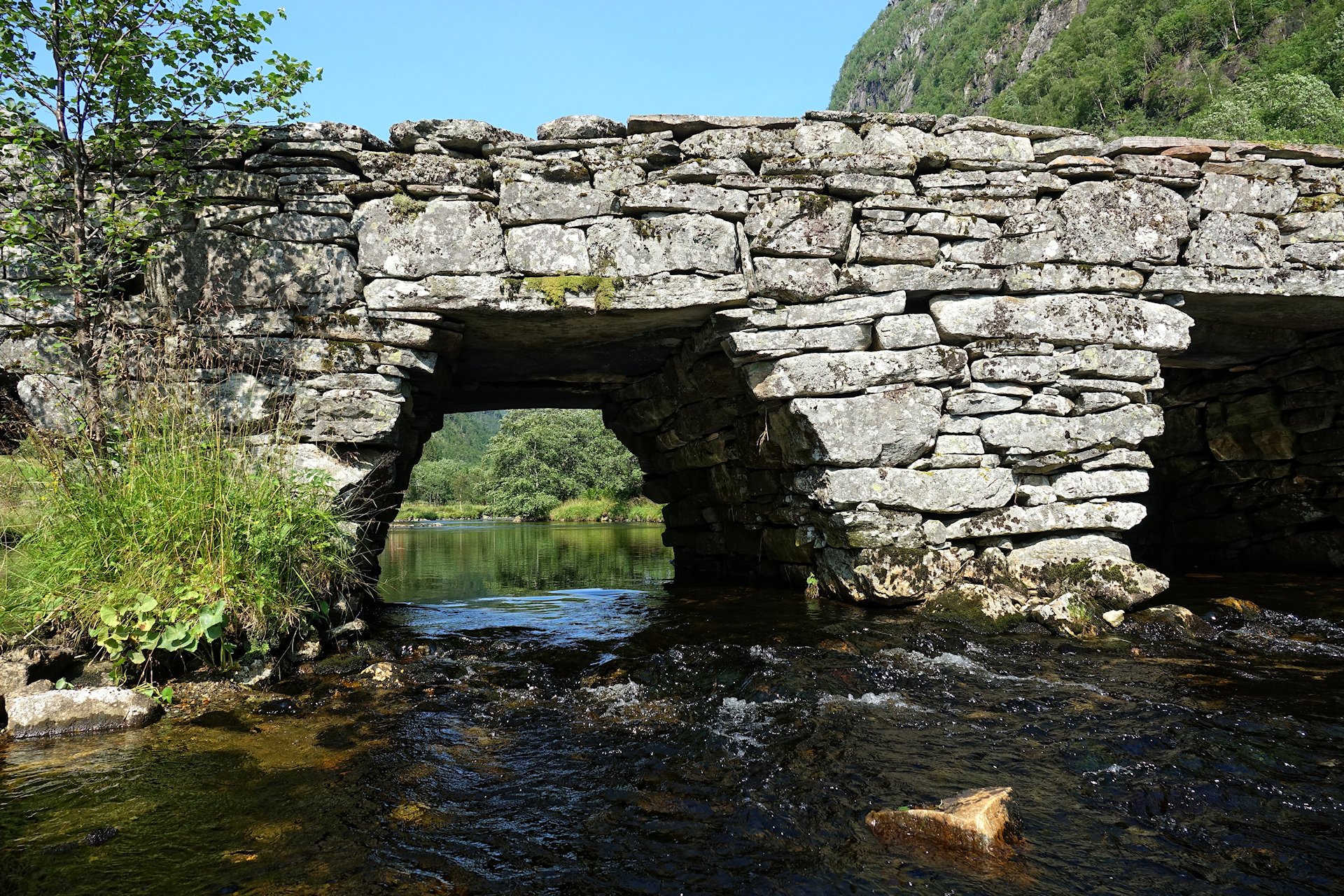
The landscape here has always restricted any human activity to a small area, so our path often crosses roads from ancient times. Here’s Ytredal bru, from the 1800s.

And here’s Dalsfjordbrua from last decade. It leads straight into a tunnel on both sides.
Norwegian engineers have come a long way in just a few centuries.
At the bridge we realize that we have to make a beeline to Bergen to get there before it gets dark. Most of the way we can follow the main “highway” through the fjords, E39, so it’s no problem.
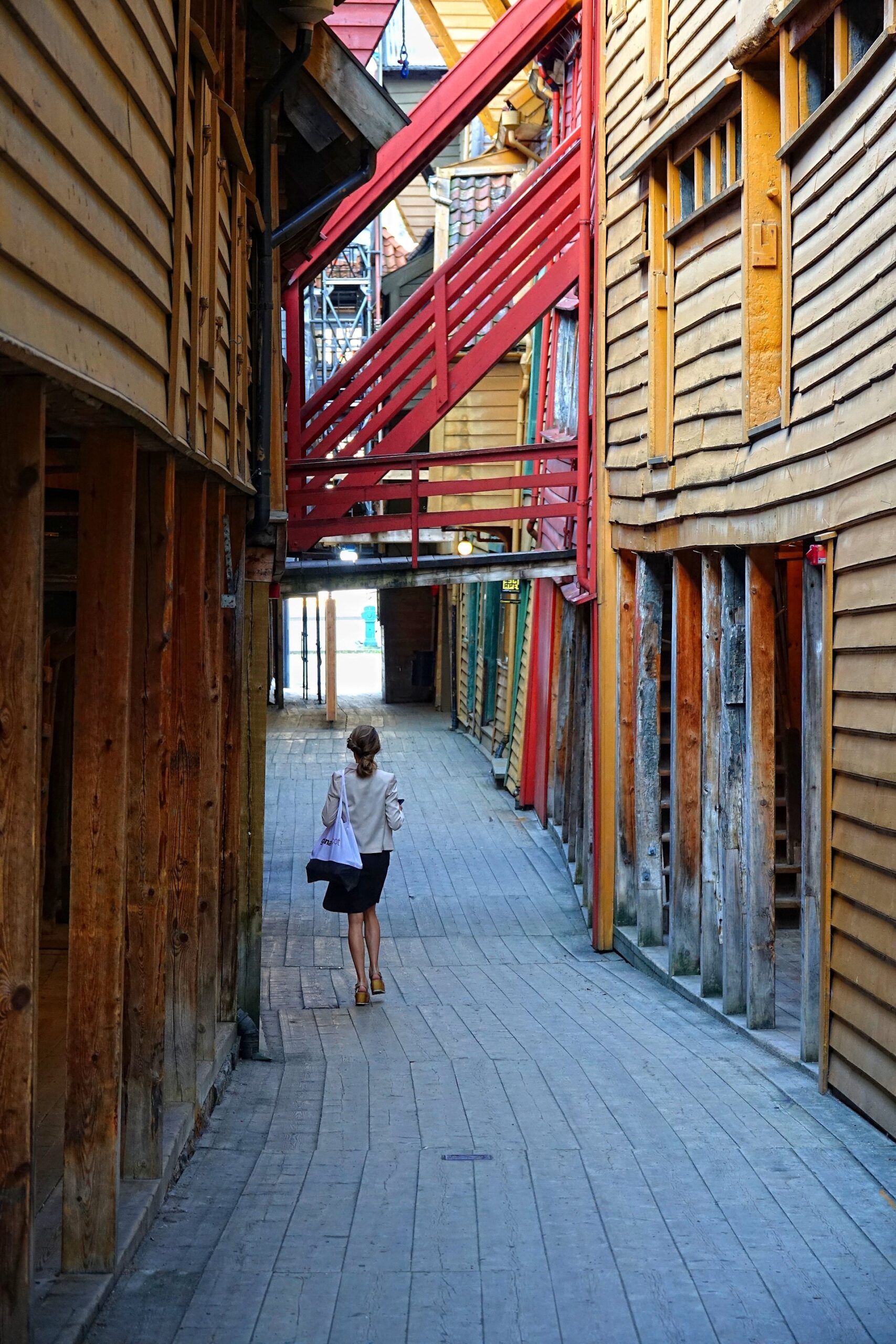
After a good sleep at Hotel No13, we go for a morning walk in Bergen. We walk through the city’s UNESCO World Heritage Site: Bryggen, an old trade center full of Hanseatic style wooden buildings.
They have really managed to keep the old atmosphere, especially now during the coronavirus lockdown. It’s easy to imagine a plague just having blasted through these empty alleys. Until this anachronism of a business woman rushes past us in high heels, that is.

At Festningskaia we see another indication of the extraordinary times we’re living through. Normally these ships would be far out in the North Sea, supplying oil installations or discovering new oil reserves. But the price of oil has tanked because of a drastically decreased demand, so now the ships are just waiting around in Bergen for new orders.
On our trip’s third day, we will explore the area south of Bergen. This will involve many bridges and several ferries. There’s no point in hurrying. Frequent roadwork and inevitable ferry waiting will slow us down whatever we do.
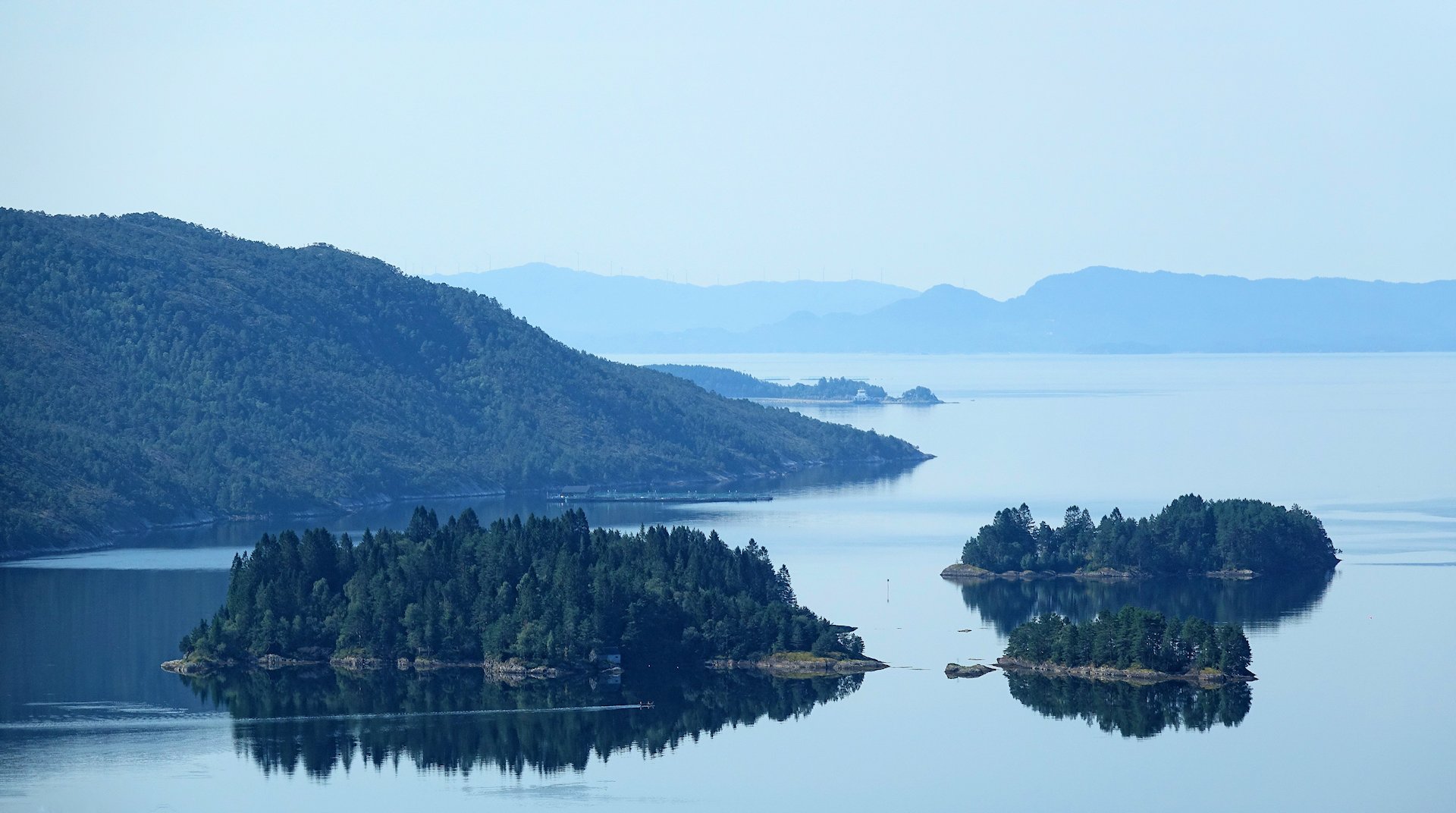
This is a view of Ådlandsfjorden, a branch of Bjørnafjorden.
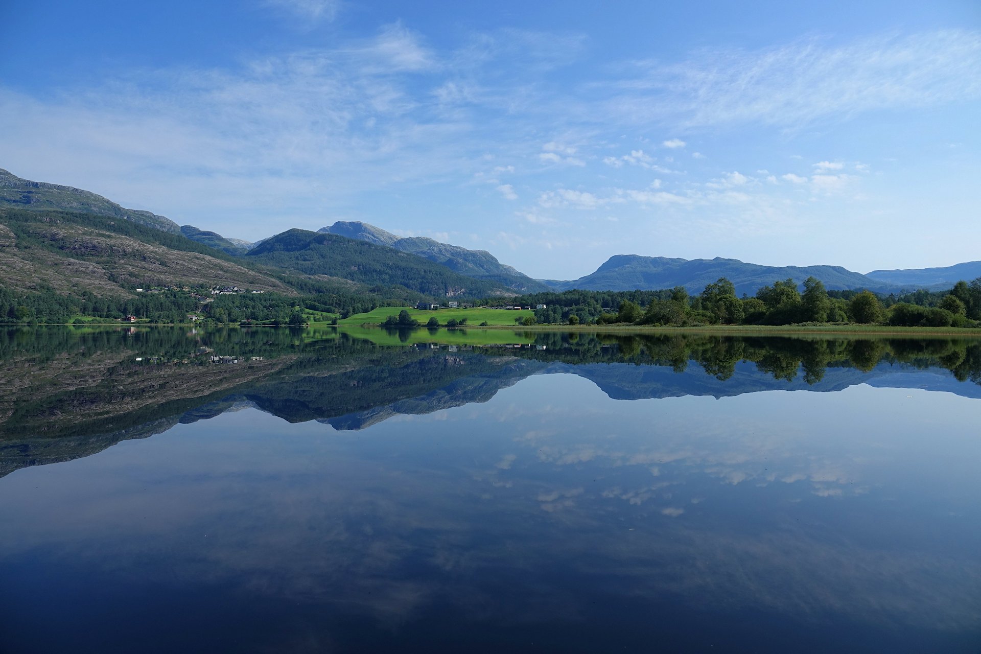
We drive towards Hardangerfjorden. On our way we pass this amazingly quiet lake, Skjelbreidvatnet. It’s the best mirror on this entire trip.
On Tysnesøya we leave the main road and head off on Fv78 to see the island’s east coast.
It’s instantly 200 % more rural, with a one lane road with guard rails that must be at least a century old, consisting of rocks all but covered in moss.
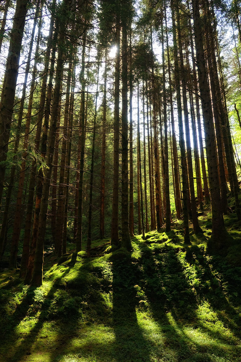
The old road takes us through an even older forest. It feels almost like a hike in the wilderness.
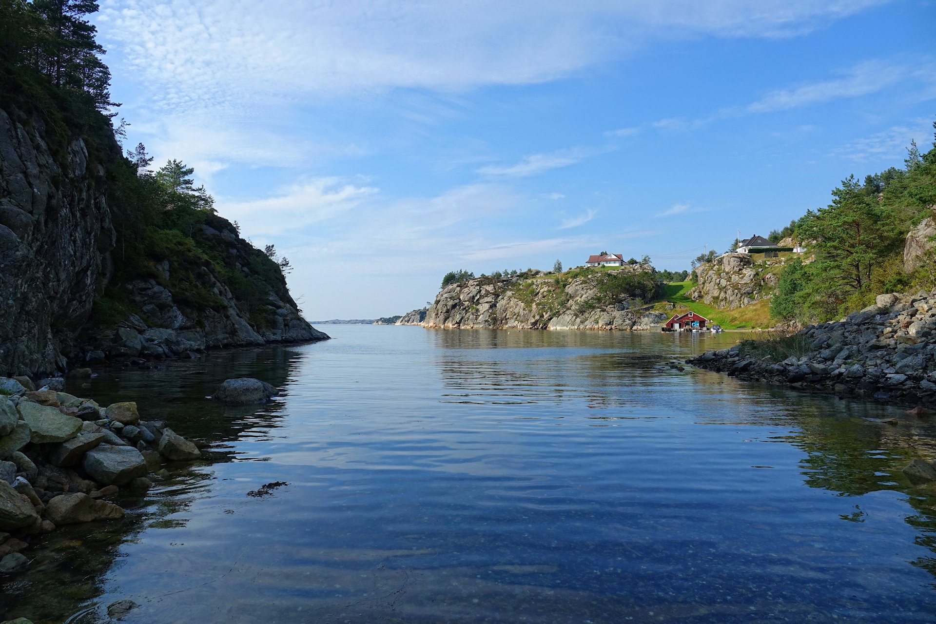
The deep forest turns out to be rather shallow. Ten minutes later we’re definitely back on the coast again, at an old trading station, Årbakka handelssted. Gotta love the seascape here.
It’s time to head back to Bergen, so we drive straight up Stord island. Every town and village between Stavanger and Bergen is full of people who have worked in the oil industry for a long time, so the entire coastline consists of secluded coves with large mansions and nice leisure boats.
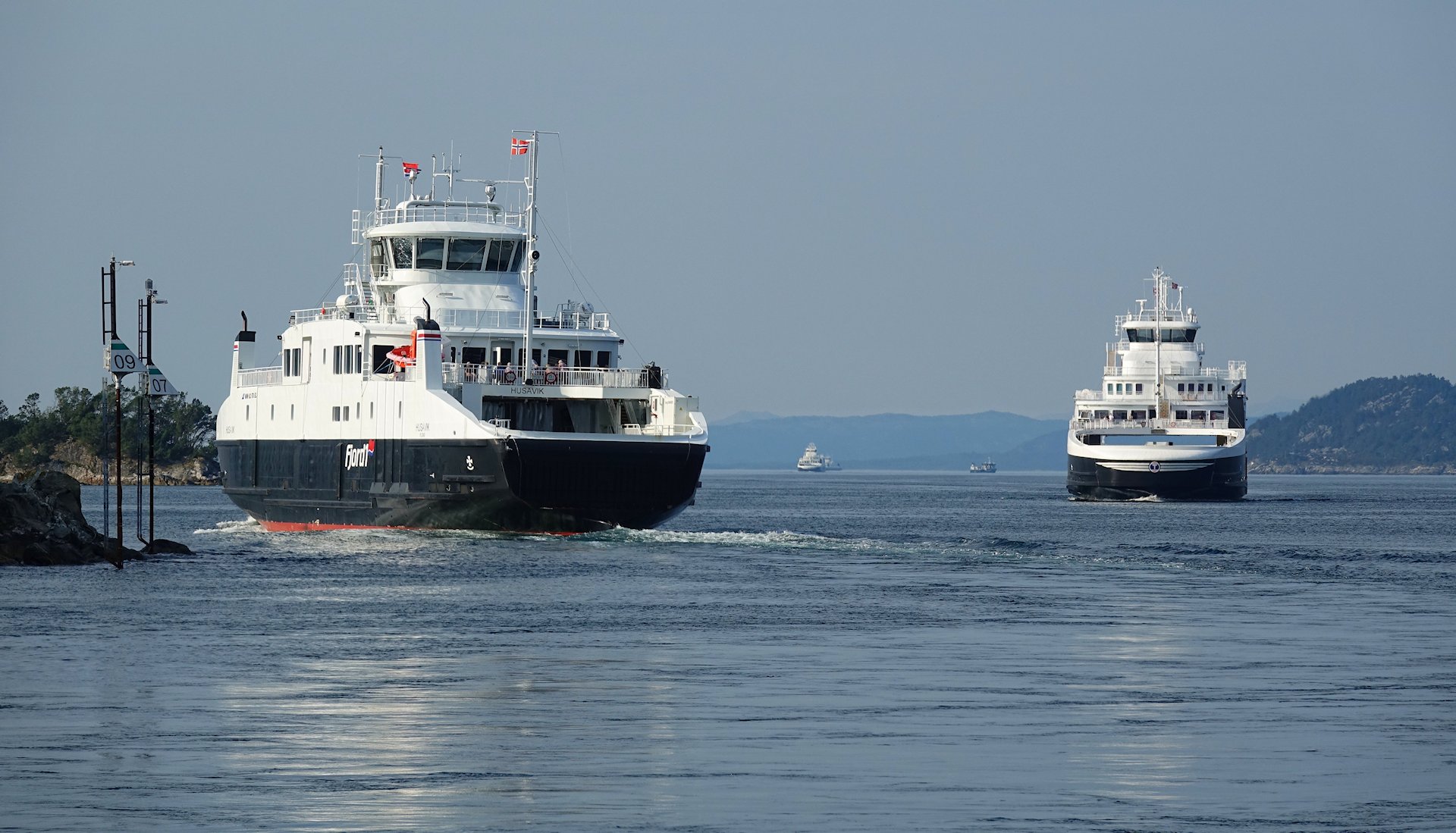
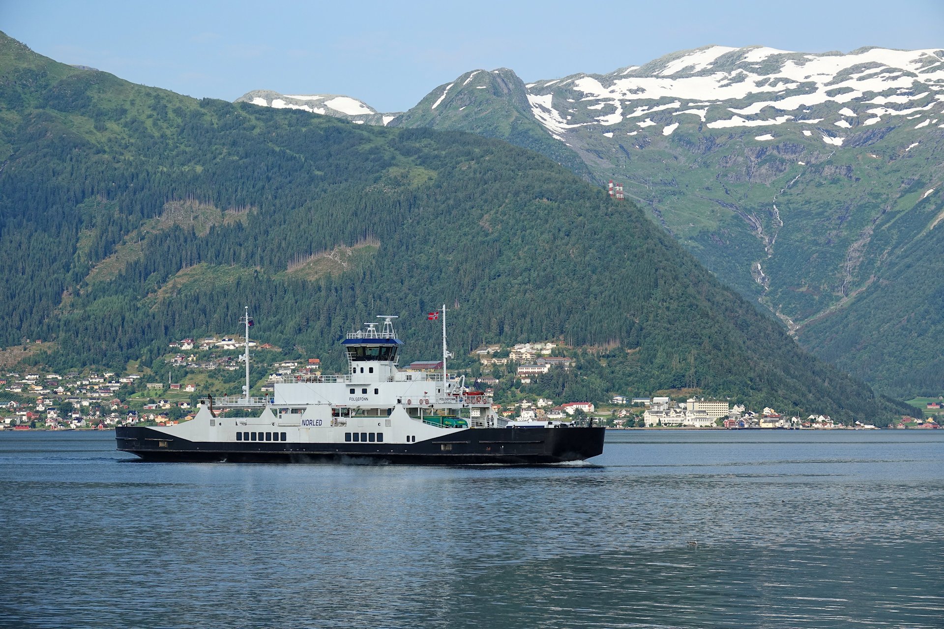
To return to the mainland and Bergen we must take another ferry. Around here there’s little waiting, though. On the main road, 39, the ferries run so frequently that they’re more like floating bridges.
I enjoy the break from driving that a ferry brings. This ferry can take up to 180 cars, so we’re quite the traveling community. If you’ve had enough scenery, watching people on vacation is a welcome change; drama and wildlife wherever you turn.
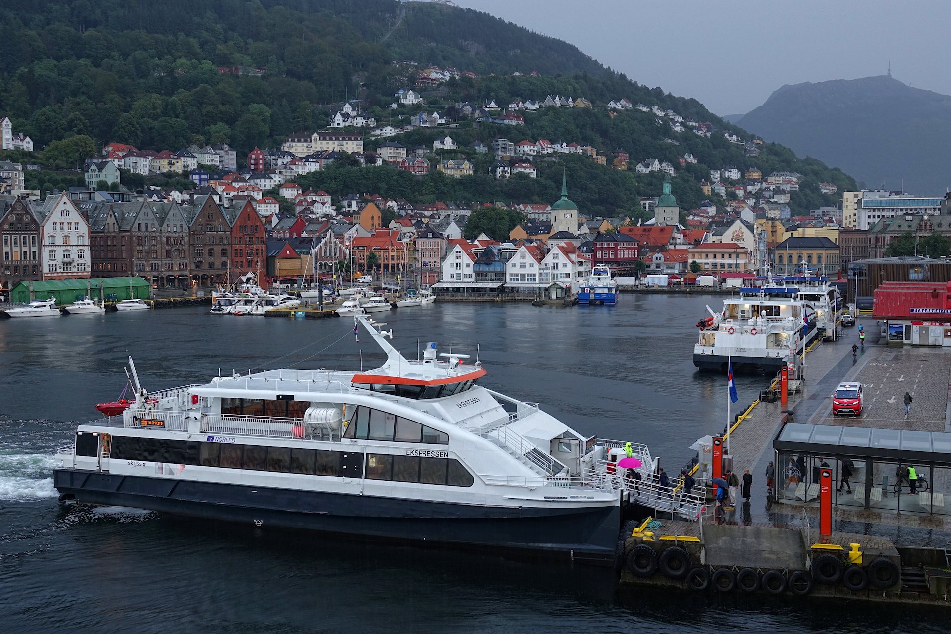
On our second night in Bergen and the last night of this trip, we stay at the central Hotel Admiral. When the sun doesn’t rise, the city is back to its normal weather pattern. We observe the morning rush, consisting of fast boats coming and going, unloading groups of umbrella carriers to their day at work.
This is what Bergen usually looks like.

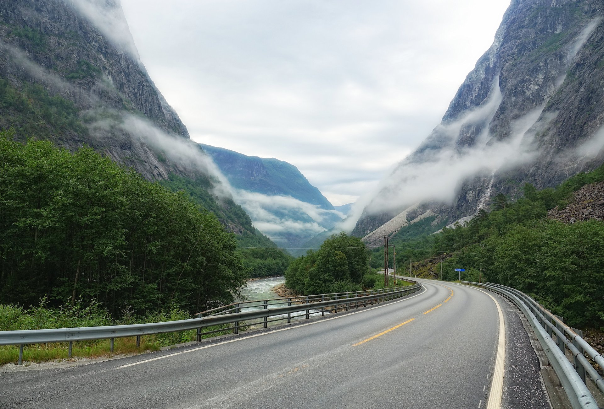
Day four is primarily a long drive back across the mountains to Oslo.
We can still see some stuff along the way. Like this one, Vossevangen. It’s a town surrounded by natural wonders that have produced a huge number of Olympic and world champions in all kinds of winter and extreme sports. Rafting, ziplining, climbing, skydiving, and more; you’ll find it all here.
On this rainy day, we settle for seeing the sights come and go through the low-hanging clouds.
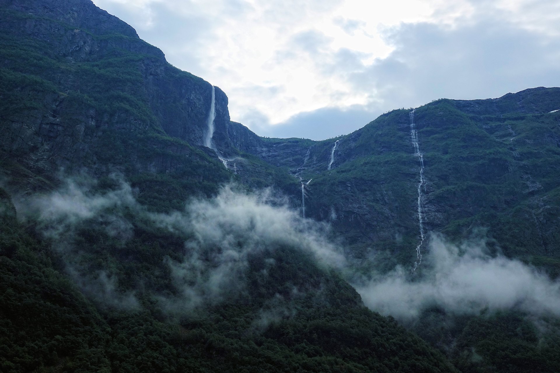
Following road E16, we enter another UNESCO World Heritage Site; the West Norwegian Fjords.
Nærøyfjorden is on the list because it is “among the most scenically outstanding areas on the planet”. Even this bit, with the main road running straight through it, looks magical with the mist clinging to the steep mountain sides. And it will get even better further down the valley, where the river enters the sea and becomes a fjord.
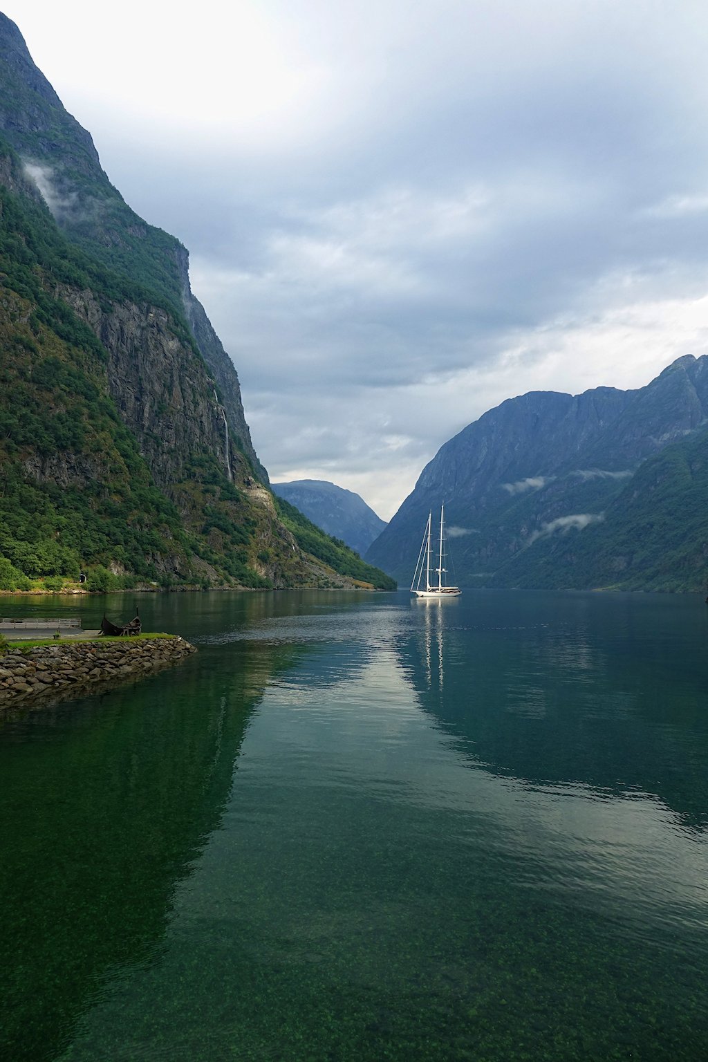
There you have it: A proper fjord, complete with a small viking ship and a modern sailboat. Even without a boat to yourself, coming to Gudvangen is a great start to experiencing the fjord landscape.
From here you have several options, and they’re all good. The laziest is to go on a mini cruise to Undredal and Flåm. If you want to burn calories, continue to Aurlandsvangen and hike to Finse, or hike or bike your way from Flåm to Finse on Rallarvegen.
I find it strange how Preikestolen and Trolltunga are the most famous hikes in Norway for foreigners, while so many superior options further north are largely overlooked.
Yes, I know. This doesn’t look like the easiest terrain for hiking. Don’t let that keep you away. You can just walk down in the valley if you prefer. But generally there is always a manageable trail somewhere that you can follow to get up to most mountain tops around here.
Still, you choose. The views here are excellent both bottom-up and top-down.
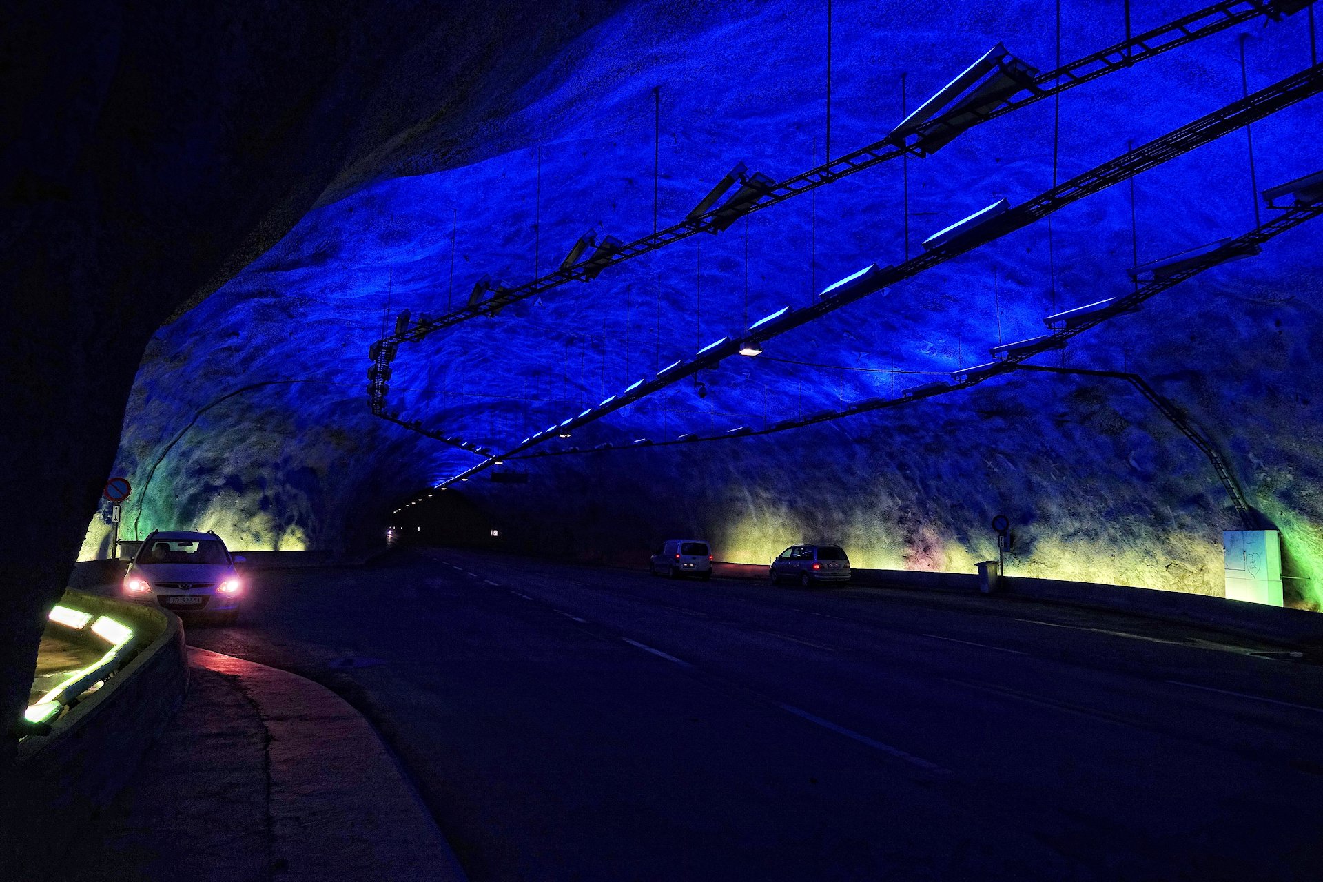
Because we’re in a hurry, we drive through Lærdalstunnelen towards Oslo. It’s the longest road tunnel in the world, measuring 24.51 kilometers from end to end.
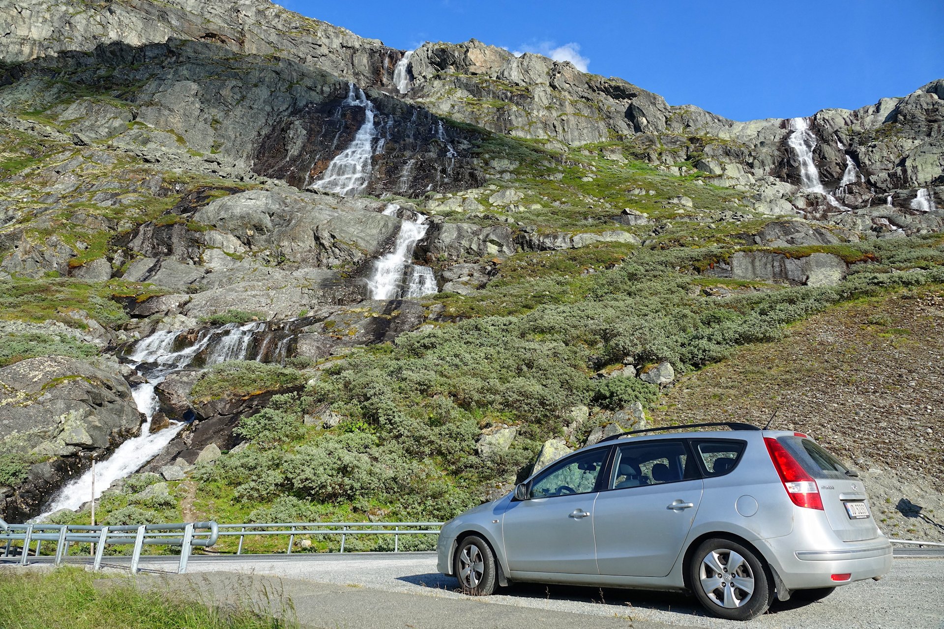
As a road safety measure, every 6 kilometers there’s a hall like this one, where you can stop and sort out any problems you may have, be they mental or mechanical. I don’t recommend leaving your vehicle, though. The noise from passing cars, including large vehicles, is deafening. But it sure looks prettier than your standard road tunnel journey.
And with this view from deep inside Norway’s mountains, this photo journal ends. Four hours later, we’re back at Oslo airport, quite happy with what we have accomplished in four days.
Thank you for coming along!
Practicalities
If you want to do the same trip, here’s the route we followed.

Transportation
All toll roads and ferries combined came to about 1,400 Norwegian kroner, and it’s the same price whether you’re one person or more in your car. If you have a car that is longer than 6 meters, it’ll cost quite a bit more. We drove altogether 1,700 kilometers, in a diesel engine car. Diesel cost between 12 and 15 kroner per liter at the time.
Accommodation
We used a special “Summer Treat” package from Nordic Choice Hotels, which worked out to 800 kroner per night at whichever hotel we used. We had to pay for 10 nights in advance, and we could sprinkle those nights throughout the entire summer, and book and cancel nights as much as we wanted.
It was a great deal, although it meant we could not wing the trip completely. Every day we had to plan it so that we were near one of their hotels by nightfall. We spent one night in Sogndal and two nights in Bergen.
Eating
For food, we just bought what we needed at grocery stores along the way. In Bergen we splashed out on take-away pizza, paying about 280 kroner (just under 30 US dollars) for a pizza larger than the two of us was able to finish.
1 Comment. Leave new
Great pictures, Bjørn and thanks for sharing. You are quite an ambassador for the Norwegian tourist industry.